
Overview
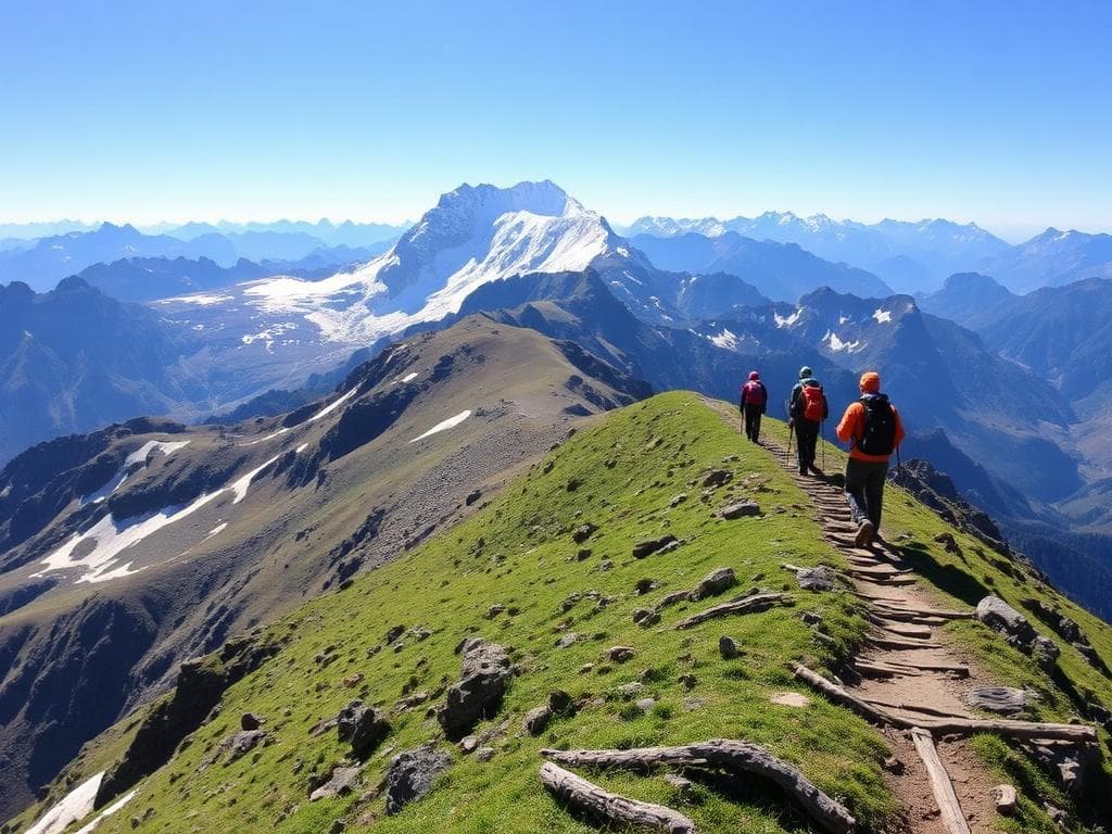
The Warwan Valley Trek takes one from two different areas of the Himalayas. The trail starts in the Suru Valley of Ladakh at Panikhar, where you can follow trails along the rivers, through meadows, uphill to some camps and a crossing over a mountain pass. Past this point is the Warwan Valley of Kishtwar, where the trails take you among steams, hills, grassy meadows, and cultivated fields.
The typical trek route visits places like Denora, Kalapari, Kaintal, Humpet, and Sukhnai, and then exits at Basmina or Chaudraman. A few versions of the trek include acclimatization days, and some schedules are longer or shorter than others. The trek is generally done as a point-to-point trek, not a loop trek.
The conditions on foot differ quite a lot. The strategy involves climbing up through slow ascents. However, some of the days on high-pass require lengthy walks and even walking over unstable moraines, rocky slopes, snow-covered passages as well as ice-cold stream crossings.
For this reason, the trekking route is recommended for experienced and well-prepared trekkers that have done challenging mountain hikes before. One of the key things for such a journey is road accessibility during certain seasons and necessary permits from the appropriate organizations: one cannot assume an open trekking route.
Highlights
- Suru Valley approach
- Denora and Sumdo basin
- Kalapari campsite
- High mountain-pass crossing
- Kaintal's glacial landscape
- Alpine meadows
- Remote settlements
- A trans-Himalayan route
Trek Details
Seasons
Departure Cities
Terrain
Itinerary
- 1
Srinagar to Panikhar
Route: Srinagar → Sonamarg → Dras → Kargil → Panikhar Description: Travel by road to Panikhar in the Suru Valley. Published schedules generally allow around 8–10 hours, although the actual journey depends on road conditions and access over mountain passes. This is a travel day rather than a trekking day. Distance: Approximately 185–265 km by road, depending on the itinerary. Overnight stay: Camp, guesthouse or homestay
- 2
Acclimatisation at Panikhar
Route: Panikhar → short local acclimatisation walk → Panikhar Description: Allow time to adjust to the altitude before beginning the trek. A short walk may be organised by the guide, but strenuous activity should be avoided. This day is particularly important because the route quickly moves into high-altitude terrain. Distance: No fixed trekking distance; local walking only. Overnight stay: Panikhar accommodation or campsite.
- 3
Panikhar to Denora
Route: Panikhar → Chalong river area → stream crossings → Sumdo basin → Denora Description: Begin the trek by following the river valley and gradually ascending through open terrain and grassy sections. The route passes streams and a broad valley basin before reaching the Denora camping area. Distance: Approximately 12–14 km. Overnight stay: Denora campsite.
- 4
Denora to Kalapari
Route: Denora → stream crossings → Kalapari Description: Walk a relatively short stage towards the next high-altitude camp. This gives the group time to rest before the longer pass-crossing day. Stream conditions and the exact campsite location can affect the route. Distance: Approximately 2–3 km in published itineraries. Overnight stay: Kalapari campsite.
- 5
Kalapari to Kaintal via the high pass
Route: Kalapari → high mountain pass → moraine and rocky descent → Kaintal Description: This is the most demanding stage in the standard itinerary. The ascent leads through exposed high-altitude terrain, followed by a descent across rocky ground and moraine. Some published schedules allow approximately 11–14 hours for this day. Weather, snow conditions and the group's pace may require changes to the plan. Distance: Approximately 17–22 km, depending on the route variant. Maximum altitude: Approximately 14,495 ft in commonly published itineraries. Overnight stay: Kaintal campsite.
- 6
Kaintal to Humpet
Route: Kaintal → stream-side trail → alpine terrain → Humpet Description: Continue through the upper Warwan landscape. The trail includes rocky sections, streams and repeated ascents and descents. Although this stage generally involves descending overall, it can still be physically demanding after the pass crossing. Distance: Approximately 16–17 km in published itineraries. Overnight stay: Humpet campsite.
- 7
Humpet to Sukhnai
Route: Humpet → mountain pastures → stream crossings → Sukhnai Description: Follow the route towards lower valley terrain, passing grassy slopes, streams and occasional shepherd settlements. The trail descends overall, but uneven surfaces and the length of the day require sustained endurance. Distance: Approximately 14–15 km. Overnight stay: Sukhnai campsite.
- 8
Sukhnai to Basmina or Chaudraiman
Route: Sukhnai → Rekenwas area → Warwan Valley settlements → Basmina/Chaudraiman Description: Continue through the lower valley, passing streams and rural settlements. The route generally descends and follows the valley landscape towards the road-accessible exit area. Distance: Approximately 16–17 km Overnight stay: Campsite or local accommodation
- 9
Basmina/Chaudraiman to Srinagar
Route: Basmina or Chaudraiman → road transfer → Srinagar Description: Travel back to Srinagar by road. The exit route and journey duration depend on the finish point, road conditions and the transport arrangement. A separate buffer day may be useful if weather or access delays are possible. Distance: Approximately 155 km for the return drive; this is not a universal figure. Overnight stay: Srinagar, if required by the travel plan.
Things to Carry
Trek reviews
Reviews are opening soon for Warwan Valley Trek. Share the route, season, difficulty, and trail experience.


