
Overview
The journey begins at Manebhanjan, the conventional entry point to the Singalila Ridge. In accordance with the planned route, trekkers may start their journey either from Manebhanjan or from Dhotrey, cutting down the distance to be covered initially. Trekkers cover the Tonglu, Tumling and Kalipokhri areas on their way up to Sandakphu.
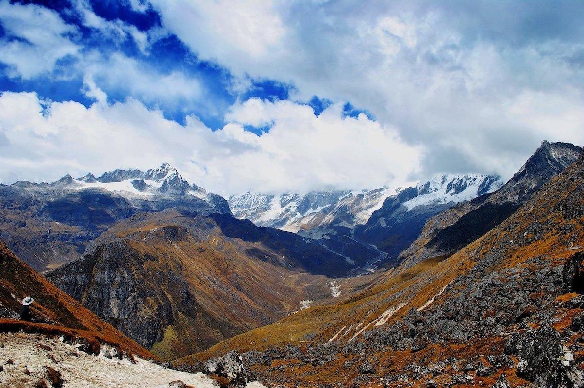
Sandakphu enjoys its fame for viewing Kanchenjunga along with other peaks that give the shape of Sleeping Buddha. On clear days, one can even catch sight of Everest, Lhotse and Makalu. Further, trekkers continue their journey to Phalut passing through ridges and the Sabarkum areas. This part is more isolated and offers limited facilities in comparison to the route leading to Sandakphu.
It is normally the case that the reverse trip takes a downward path to pass through such towns as Gorkhey, Rammam and Srikhola before getting to Rimbik. During spring, there will be flowering of rhododendrons and during autumn, it is often preferred.
Photos And Videos
Highlights
- Sandakphu viewpoint
- The Sandakphu–Phalut ridge
- Rhododendron and magnolia forests
- Gorkhey and remote mountain villages
Trek Details
Seasons
Departure Cities
Terrain
Itinerary
- 1
NJP / Bagdogra to Dhotrey; trek to Tumling
Drive to Dhotrey, a common starting point for the trek. Walk through forest trails towards Tonglu and Tumling. Stay in a local lodge or guesthouse. Trekking: approximately 8–11 km Tumling: approximately 2,900 m / 9,514 ft
- 2
Tumling to Kalipokhri
Continue through the Singalila landscape via Jaubari and Gairibas. Walk through forest and open hillside sections. Stay near Kalipokhri. Trekking: approximately 13–15 km Kalipokhri: approximately 3,180 m / 10,433 ft
- 3
Kalipokhri to Sandakphu
Climb towards Bikeybhanjan and continue to Sandakphu. Explore the viewpoint when weather and visibility permit. Stay in available local accommodation. Trekking: approximately 6–7 km Altitude: 3,636 m / 11,929 ft
- 4
Sandakphu to Sabarkum or Molley
Follow the ridge south-to-north towards Phalut. Pass through open mountain terrain and the Sabarkum area. Overnight at an available designated trekkers' hut or camp. Trekking: approximately 14–16 km Sabarkum area: roughly 3,500 m / 11,483 ft
- 5
Sabarkum / Molley to Phalut, then Gorkhey if feasible
Continue to Phalut and take in the mountain panorama. Descend towards Gorkhey only if the confirmed route, daylight and conditions make this appropriate. A separate overnight stop may be necessary. Sandakphu to Phalut: approximately 21 km total Phalut: approximately 3,600 m / 11,811 ft
- 6
Gorkhey to Srikhola via Rammam
Descend through forest and village paths. Continue towards Srikhola, a riverside settlement. Stay overnight locally.
- 7
Srikhola to Rimbik; road transfer out
Complete the final section towards Rimbik, or use arranged road transport if that is the approved itinerary. Continue by road towards Darjeeling or Siliguri.
Things to Carry
Trek reviews
Reviews are opening soon for Sandakphu–Phalut Trek. Share the route, season, difficulty, and trail experience.