
Overview
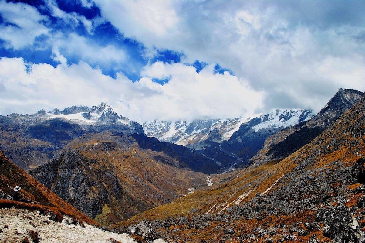
Danphebir La is famous because of its isolation and stunning mountain beauty. At the bottom level, there is dense forest consisting of rhododendron, bamboo, and many more Himalayan plants. As we go higher, the forest gets replaced by mountain ridges, alpine grassland, stony terrain, and lakes like Lampokhari, Lachmi Pokhari, and Zomley Pokhari.
This pass lies on a ridge near the Nepal border. On a clear day, the view may encompass the Kanchenjunga massif and the faraway mountains like Mount Everest, Lhotse, and Makalu. The neighboring Kag Bhir La lookout point is one of the highlights of the high ridge.
This is a strenuous and challenging trek in high altitude. It includes ascents, descents, exposed ridges, rapid weather changes and even ice. It needs the guidance of professional guides with appropriate acclimatization and confirmation of access to the route.
Photos And Videos
Highlights
- Danphebir La Pass
- High-altitude lakes
- Lampokhari
- Rhododendron forests
- Kanchenjunga and Himalayan panoramas
Trek Details
Seasons
Departure Cities
Terrain
Itinerary
- 1
NJP to Uttarey
Drive from New Jalpaiguri (NJP) towards Uttarey. Settle into local accommodation and prepare for the trek. Road journey: approximately 150–170 km · 7–8 hours Altitude: about 2,000 m / 6,562 ft
- 2
Uttarey to Chewabhanjang
Trek through the forest and cross the Sapa Khola stream area. Pass Chitrey before climbing towards Chewabhanjang near the border. Trekking time: approximately 5 hours Altitude: about 3,100 m / 10,171 ft
- 3
Chewabhanjang to Dhoor
Continue along the Singalila Ridge. Cross rolling ridges and forest sections before reaching the higher campsite. Trekking time: approximately 8 hours Altitude: about 3,800 m / 12,467 ft
- 4
Dhoor to Meghuthang
Follow the high ridge through open meadows and rocky sections. Weather may become colder and windier as the trail gains elevation. Trekking time: approximately 8 hours Altitude: about 3,900 m / 12,795 ft
- 5
Meghuthang to Lampokhari Lake
Continue across increasingly open alpine terrain. Reach the high-altitude lake area and the designated campsite. Trekking time: approximately 5 hours Altitude: about 4,300 m / 14,108 ft
- 6
Lampokhari to Gomathang via Danphebir La
Cross the high pass with the professional expedition team. Continue via Kag Bhir La if included in the approved route. Descend towards Gomathang. Trekking time: approximately 8 hours Highest point: about 4,530 m / 14,862 ft Gomathang: about 3,800 m / 12,467 ft
- 7
Gomathang to Tyabla
Continue through the remote highland trail. Descend gradually towards the next campsite. Trekking time: approximately 6 hours Altitude: around 3,700 m / 12,139 ft
- 8
Tyabla to Dzongri
Follow the connecting mountain trail towards Dzongri. Join the established Goechala trekking corridor. Trekking time: approximately 6 hours Altitude: around 4,300 m / 14,108 ft
- 9
Dzongri to Bakhim
Descend through the mountain trail and forest. Stay at the designated camp or lodge. Trekking time: approximately 7 hours Altitude: around 2,850 m / 9,350 ft
- 10
Bakhim to Yuksom
Continue descending through the established trail. Reach Yuksom and stay in a guesthouse. Trekking time: approximately 6 hours Yuksom: around 1,780 m / 5,840 ft
- 11
Yuksom to NJP
Return by road to New Jalpaiguri or Bagdogra. Road journey: approximately 150 km · allow a full day
Things to Carry
Trek reviews
Reviews are opening soon for Danphebir La. Share the route, season, difficulty, and trail experience.