
Overview
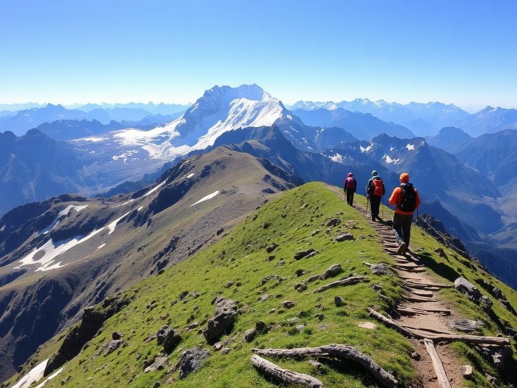
The Pir Panjal Lake Trek is a trekking route that follows a high altitude track in the Pir Panjal range of Jammu & Kashmir. The selected route begins from Chandimarh in Poonch area and ends near Peer Ki Gali through a series of alpine meadows, lakes and passes before going down to the road.
At the beginning, the trek goes through forest and meadow land to reach Thera and Khuan. As the trek progresses in altitude, the land becomes open grassy slopes and alpine valleys. Neelsar is one of the first few lakes that can be found on this route. Others include Chandansar and Nandansar.
Trekking normally takes about seven days to complete, with the road transfer from Srinagar and exit from the trail included in the time. The published itinerary states around 48 kilometers of trekking, though the daily trek and altitudes differ somewhat among operators. Trekking with long walks, difficult climbs, boulders, and river crossings requires proper physical preparation.
The normal trekking season is usually from July to September; however, conditions like snow, rains, and access issues may have an impact on the trekking trail. The chosen Chandimarh itinerary needs to be differentiated from the separate Pir Panjal Lakes itinerary from Yusmarg.
Highlights
- Neelsar Lake
- Chandansar Lake
- Nandansar Lake
- Thera Meadows
- Khuan and Byad Meadows
- Handusar high point
- Peer Ki Gali
- Forest-to-alpine transition
Trek Details
Seasons
Departure Cities
Terrain
Itinerary
- 1
Srinagar to Chandimarh
Route: Srinagar → Shopian → Mughal Road → Chandimarh Description: Travel from Srinagar to Chandimarh, the starting point for the trek. The drive follows the Mughal Road through mountain scenery and takes approximately 4–5 hours in the published itinerary. This is a road-transfer day, not a trekking day. Distance: Approximately 127–129 km by road. Overnight stay: Guesthouse, lodge or camping arrangement organised at Chandimarh.
- 2
Chandimarh to Thera
Route: Chandimarh → Noori Chamb waterfall area → Cheii village vicinity → Thera Meadows Description: Begin the trek with a sustained ascent from Chandimarh towards Thera. The trail passes the Noori Chamb waterfall area before entering forest and meadow terrain. This stage involves a significant elevation gain and is one of the more demanding early days. Trekking distance: Approximately 7.8 km. Altitude: Approximately 5,986 ft at the start and 9,357 ft at Thera. Estimated walking time: 7–8 hours. Overnight stay: Thera campsite.
- 3
Thera to Khuan
Route: Thera → forest section → ridge and meadow trail → Panjdhari vicinity → Khuan Description: Continue through forest and open meadow terrain. The trail includes an initial climb followed by a longer walk across the meadows towards Khuan. Expect a mixture of gradual ascent, uneven ground and shorter steep sections. Trekking distance: Approximately 9.2 km. Altitude: Approximately 9,357 ft at Thera and 10,900 ft at Khuan. Estimated walking time: 8–9 hours. Overnight stay: Khuan campsite.
- 4
Khuan to Neelsar
Route: Khuan → Byad Meadows → boulder section → Neelsar Lake Description: Descend briefly from the Khuan meadows before climbing towards Byad Meadows. The upper section includes boulders and a steep approach to Neelsar. The trail can be exposed to rockfall and landslides, so follow the guide's instructions and avoid crossing unstable sections during poor conditions. Trekking distance: Approximately 5.5 km. Altitude: Approximately 10,900 ft at Khuan and 12,170 ft at Neelsar. Estimated walking time: Around 6 hours. Overnight stay: Neelsar campsite.
- 5
Neelsar to Chandansar
Route: Neelsar → upper lake basin → Kaldachni Pass → Chandansar Description: Continue through the high-altitude lake region. This stage involves rocky and boulder-strewn ground, meadow sections and stream crossings near the pass. The route is longer and more demanding than the distance alone suggests. Trekking distance: Approximately 7 km. Altitude: Approximately 12,170 ft at Neelsar and 12,923 ft at Chandansar. Estimated walking time: 8–9 hours. Overnight stay: Chandansar campsite.
- 6
Chandansar to Nandansar via Handusar
Route: Chandansar → Khabi Ki Gali vicinity → Handusar high point → Nandansar Description: Cross high ground towards Handusar and continue through the alpine lake landscape to Nandansar. The route involves further ascent and descent over uneven terrain. Weather and snow conditions can significantly affect this stage. Trekking distance: Approximately 9.2 km. Altitude: Approximately 12,923 ft at Chandansar; the route reaches a reported high point near 13,330 ft before descending towards Nandansar at approximately 12,313 ft. Estimated walking time: 7–8 hours. Overnight stay: Nandansar campsite.
- 7
Nandansar to Peer Ki Gali; drive to Srinagar
Route: Nandansar → Kalasar vicinity → Peer Ki Gali → road transfer to Srinagar Description: Begin with a climb from the Nandansar basin towards the pass, passing the small lake of Kalasar along the route. Continue over high ground before descending towards Peer Ki Gali. Once at the roadhead, transfer to Srinagar. The final day combines trekking and road travel, so departure timing should remain flexible. Trekking distance: Approximately 9.6 km. Altitude: Nandansar is listed at approximately 12,313 ft; the highest point on this final stage is reported at approximately 13,727 ft, with Peer Ki Gali at around 11,447 ft. Estimated walking time: 6–7 hours, followed by the road transfer. Overnight stay: Srinagar
Things to Carry
Trek reviews
Reviews are opening soon for Pir Panjal Lakes Trek. Share the route, season, difficulty, and trail experience.


