
Overview
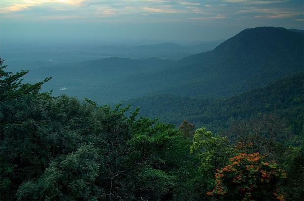
The Banasura Hills form one of the most prominent highland landscapes of Wayanad. The hills have an elevation of about 2,073 metres (6,801 feet), which offer scenic views over the Banasura Sagar dam and the forests around. The trek is known for its lush greenery, open grassy areas, and rocky terrain.
The hike is likely to be strenuous owing to the steepness of some parts and also the lengthiness of the long hike. The forest might also be full of leeches, thorny bushes, and slippery terrain. It is imperative that the hike should only take place following the existing route authorized by the Forest Department.
The Banasura Sagar Dam and the Meenmutty Waterfalls in close proximity to the trekking area may be visited separately depending on their entry procedures.
Photos And Videos
Highlights
- Banasura hilltop views
- Banasura Sagar Dam
- Forest and grassland terrain
- Meenmutty Waterfalls
Trek Details
Seasons
Departure Cities
Terrain
Itinerary
- 1
Bengaluru to Wayanad
Night before: Depart Bengaluru by overnight transport. Route: Bengaluru → Mysuru → Gundlupet → Sulthan Bathery → Kalpetta / Padinjarathara. Road distance: Approximately 280–300 km. Travel time: Around 6–8 hours, depending on traffic and stops. Activities: Arrive in Wayanad, have breakfast, freshen up and rest at the accommodation. Night halt: Wayanad.
- 2
Banasura Hill Trek
Morning: Travel to the authorised forest entry point and complete the entry formalities. Trek route: Follow the forest-approved route, commonly associated with Meenmutty–Kattukunnu–Aanchola. Trekking distance: Route-dependent; some published summit itineraries describe approximately 15 round trip. Summit altitude: Approximately 6,800 ft. Duration: Allow most of the day for the guided trek. Evening: Return to the accommodation if permitted by the trekking schedule. Night halt: Wayanad.
- 3
Wayanad to Bengaluru
Morning: Breakfast and check-out. Optional stop: Banasura Sagar Dam, if time permits and it is not already part of your plan. Return route: Padinjarathara → Sulthan Bathery → Gundlupet → Mysuru → Bengaluru. Road distance: Approximately 280–300 km. Travel time: Around 6–8 hours. Arrival: Bengaluru, usually by evening depending on departure time and traffic.
Things to Carry
Trek reviews
Reviews are opening soon for Banasura Hill Trek. Share the route, season, difficulty, and trail experience.