
Overview
Bagini Glacier & Changabang Base Camp Trek is a difficult high altitude trek in Chamoli district of Uttarakhand state situated amidst the rugged terrain of Garhwal Himalaya, in proximity to Nanda Devi area. The trail goes through traditional Himalayan villages like Ruing and Dronagiri and then traverses the terrain of valleys, moraines, glacial streams and snow clad peaks.
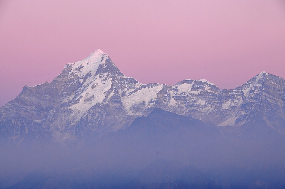
The treks through Bagini Glacier and Changabang Base Camp allow one to experience stunning sights of the Changabang, Dunagiri, Kalanka, and many other Himalayan peaks. This trek provides for an excellent blend of breathtaking mountain scenery, culture, and outdoor exploration. Owing to its altitude and tough trail, this trek is better done by trekkers with considerable experience.
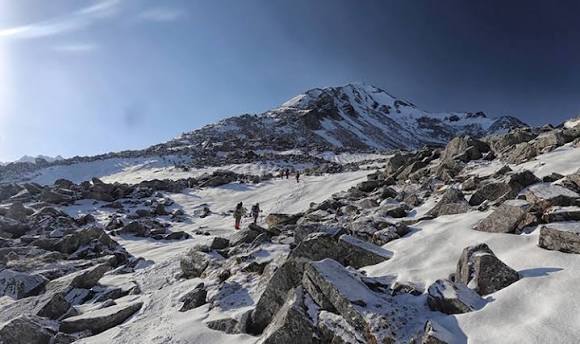
This trek is well-known for its challenging terrain and beautiful views of peaks like Changabang, Kalanka, Dunagiri, and Rishi Pahar. In contrast to treks on grassy meadows that are famous amongst trekkers, the higher part of this trek has many rock faces and moraines.
The route and terrain
- Jumma: Road end on the Joshimath-Malari route and the starting point for the trek.
- Ruing: Small village visited during the first part of the trek.
- Dronagiri village: Traditional Himalayan village located among high peaks.
- Longatulli: High-altitude stop before moving on to more exposed terrain.
- Bagini Base Camp: Rugged base camp located near the glacier and the surrounding mountains.
- Changabang Base Camp: The end of the long trek route with views of a stunning mountain amphitheatre.
Photos And Videos
Highlights
- Bagini Glacier
- Changabang Base Camp
- Dronagiri village
- High-altitude wilderness
Trek Details
Seasons
Departure Cities
Terrain
Itinerary
- 1
Rishikesh to Joshimath
Drive day Approx. 250 km · 8–10 hours Travel through the mountain roads of Uttarakhand to Joshimath. Use the evening to rest, confirm permits and meet the trek team.
- 2
Joshimath to Jumma, then Ruing
Trek begins About 3 km on foot · Ruing approx. 9,200 ft Drive to Jumma and hike to Ruing. This is a shorter walking day that introduces the route and gives the group time to settle in.
- 3
Ruing to Dronagiri village
Long trekking day About 7.5–8 km · Approx. 11,300–11,850 ft Follow forested paths and sections of steep, unstable terrain before reaching Dronagiri. The route includes a landslide-prone section, so follow the guide's instructions and avoid shortcuts.
- 4
Dronagiri to Longatulli
Altitude gain About 6–6.5 km · Approx. 12,800–13,000 ft Continue into more exposed mountain terrain. The trail includes rocky sections and ascents and descents. Longatulli is an important point to rest and acclimatise before going higher.
- 5
Longatulli to Bagini Base Camp
High-altitude terrain About 5–6 km · Around 14,800–15,100 ft on published itineraries Travel across increasingly rocky terrain towards the Bagini glacier basin. Expect limited vegetation, cold winds and a demanding walking surface.
- 6
Bagini Glacier and Changabang Base Camp area
Destination day Distance varies by route; some itineraries report 6–10 km With the guide's approval and suitable conditions, explore the glacier viewpoint and continue towards Changabang Base Camp. Some versions of the route report elevations near 16,000–16,100 ft. The exact destination and return distance must be verified locally.
- 7
Return towards Dronagiri village
Descent Approximately 10–12 km on some itineraries Retrace the rocky trail towards lower camps and Dronagiri. Descending over moraine and uneven ground can be tiring even when altitude is decreasing.
- 8
Dronagiri to Jumma, then Joshimath
Exit day Trek distance varies; vehicle transfer after reaching the road Descend via Ruing to Jumma and transfer to Joshimath. The trekking distance depends on the overnight location and the exact route followed.
- 9
Joshimath to Rishikesh
Return drive Travel back to Rishikesh. Keep a buffer day in your overall travel plan for road delays, weather or changes to the trekking schedule.
Things to Carry
Trek reviews
Reviews are opening soon for Bagini Glacier and Changbang Base Camp Trek. Share the route, season, difficulty, and trail experience.