
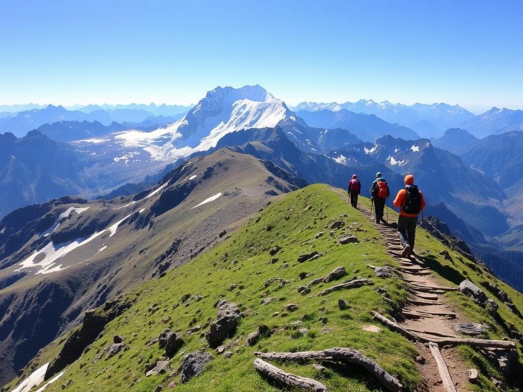
Overview
The Annapurna Circuit Trek is perhaps one of the most famous long trekking routes in Nepal. The route goes around much of the Annapurna mountain massif, with scenery ranging from greener valleys with riverbanks and villages to the steeper alpine areas surrounding Manang and beyond.
Modern routes usually start from Besisahar or Chame, depending on road conditions and plans made by the trekking company. Along the way, there are usually settlements like Pisang and Manang where visitors get a taste of the local mountain culture, Buddhism, monasteries, and architecture.
The Thorong La Pass at about 5,416 metres above sea level is the key geographical landmark of the trekking route and the highest point of this route. It is necessary to have proper acclimatisation, professional guidance, and good weather conditions for passing through this high mountain pass. On the other side of the pass, the trail goes down to Muktinath, an important pilgrimage site in both Hinduism and Buddhism.
Spring and autumn are considered the best periods for this trek. Nevertheless, snow, storms, avalanches, and road conditions might become obstacles for passing the trekking route in any season. Another place that can be visited during the trek is Tilicho Lake.
Highlights
- Thorong La Pass
- Manang Valley
- Traditional Himalayan villages
- Muktinath
- Contrasting landscapes
- Tilicho Lake extension
Trek Details
Seasons
Departure Cities
Terrain
Itinerary
- 1
Arrive in Kathmandu
No trekking Arrive, settle into your accommodation and prepare for the journey. Check your gear and trekking arrangements.
- 2
Kathmandu to Dharapani
Road transfer · Approximately 7–9 hours Travel via Besisahar and continue by local vehicle to Dharapani, around 1,860 m. Road times vary with conditions.
- 3
Dharapani to Chame
15 km · 5–6 hours Trek through forests and traditional settlements along the Marsyangdi River valley to Chame, around 2,670 m.
- 4
Chame to Upper Pisang
14 km · 5–6 hours Pass pine forests, suspension bridges and dramatic rock formations. Stay in Upper Pisang, around 3,300 m.
- 5
Upper Pisang to Manang via Ghyaru and Ngawal
17 km · 7–8 hours Take the scenic upper route through traditional villages with wide Himalayan views. Arrive in Manang, approximately 3,540 m.
- 6
Acclimatisation in Manang
Optional short hike Rest and explore the village or visit a nearby viewpoint. Keep the day easy to prepare for higher elevations.
- 7
Manang to Yak Kharka
10 km · 4–5 hours Ascend gradually through open alpine terrain to Yak Kharka, around 4,050 m. Rest after arrival.
- 8
Yak Kharka to Thorong Phedi
7–8 km · 4–5 hours Continue along the rocky high-altitude trail to Thorong Phedi, around 4,450 m. Keep the afternoon for rest and preparation.
- 9
Thorong Phedi to Muktinath via Thorong La
15–17 km · 8–10 hours Cross Thorong La Pass (5,416 m) and descend to Muktinath, around 3,800 m. This is the trek's most demanding day and should only be attempted when local conditions are safe.
- 10
Muktinath to Tatopani
Road transfer · Several hours Visit Muktinath if time allows, then take a local vehicle through Jomsom and the Kali Gandaki Valley to Tatopani. This road transfer keeps the itinerary within 15 days.
- 11
Rest day in Tatopani
Optional local walk Take a recovery day, explore the village or visit the local hot springs if open. Rest before the climb towards Ghorepani.
- 12
Tatopani to Ghorepani
16–18 km · 7–9 hours Climb through terraced farmland, villages and forest to Ghorepani, around 2,870 m. Start early and allow time for the sustained ascent.
- 13
Poon Hill to Tadapani
8–10 km · 4–6 hours, including the viewpoint Optionally hike to Poon Hill for sunrise, return to Ghorepani for breakfast, then trek through rhododendron forest to Tadapani.
- 14
Tadapani to Ghandruk, then Pokhara
7–9 km trek · 3–4 hours, then road transfer Descend to Ghandruk, a traditional Gurung village, then continue by vehicle to Pokhara.
- 15
Pokhara and onward travel
Rest or travel day Enjoy time around Phewa Lake or travel onward. If you need to return to Kathmandu by road, arrange transport and departure timing in advance.
Things to Carry
Trek reviews
Reviews are opening soon for Annapurna Circuit Trek. Share the route, season, difficulty, and trail experience.

